Manassas trails: battlefield loops from 0.9 to 6.6 miles with parking at each trailhead, city park paths, Civil War fort walks and new shared-use paths.
Last checked Oct. 19, 2026. Trail distances, times and trailheads come from the National Park Service; city park trails from the City of Manassas parks page and trail and sidewalk projects page.
The longest and best-marked trails near Manassas are at Manassas National Battlefield Park, just north of the city: more than 40 miles of hiking and horse trails over nearly 5,100 acres, free and open dawn to dusk. Inside the city, shorter paths loop through Dean Park, Byrd Park, Stonewall Park and the grounds of two Civil War forts. Battlefield questions: 703-361-1339. City parks: 703-368-1873.
What this means for you
- Short on time: the Henry Hill Loop (1.1 miles) or Matthews Hill Loop (0.9 mile).
- Half a day: the First Manassas Trail (5.4 miles) or Second Manassas Trail (6.6 miles).
- Map: pick one up at the Henry Hill Visitor Center or download the park’s hiking trail map.
- Blazes: blue for hiking, yellow for horse trails.
Battlefield trails
| Trail | Distance | Time | Trailhead and parking |
|---|---|---|---|
| Matthews Hill Loop | 0.9 mile | Not listed | Matthews Hill parking lot (Tour Stop 4) |
| Henry Hill Loop | 1.1-mile circuit | 1 hour; 120 feet of climb | Behind the Henry Hill Visitor Center |
| Stone Bridge Loop | 1.3 miles | 1 hour | Stone Bridge parking lot (Tour Stop 12) |
| Brawner Farm Loop | 1.6 miles round trip | 1 hour | Brawner Farm lot off Pageland Lane (Tour Stop 1) |
| First Manassas Trail | 5.4-mile circuit | 2+ hours | Henry Hill Visitor Center |
| Second Manassas Trail | 6.6 miles round trip | 3+ hours | Henry Hill Visitor Center, with other access points |
Times are the park’s averages and do not allow for rest or stops.
What you will see
- Henry Hill Loop: Ricketts’ Union battery, the rebuilt Henry House and the grave of Judith Carter Henry, the only civilian killed in the first battle, and the 1865 monument raised by Union soldiers. The loop passes the spot where Thomas J. Jackson got the nickname “Stonewall.”
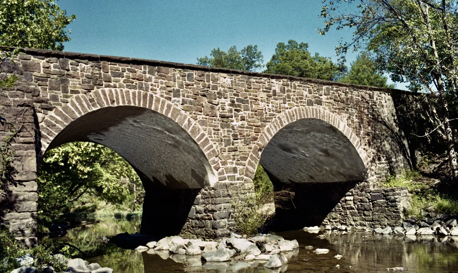
- Stone Bridge Loop: crosses the postwar Stone Bridge over Bull Run, follows the stream past spring wildflowers and fall color, climbs to the Farm Ford overlook and returns over a wooden boardwalk through a marsh the park calls good for birding.
- Brawner Farm Loop: a paved path to the Brawner Farm Interpretive Center (open March to November) and Battery Heights, through some of the deadliest fighting of Second Manassas.
- First Manassas Trail: woods from the visitor center to the Stone Bridge, then upstream along Bull Run and back over farm fields.
- Second Manassas Trail: north past the Stone House (open seasonally) to Buck Hill, with views toward the unfinished railroad where Jackson’s line stood.
Rules: dogs on a 6-foot leash on all trails; bag pet waste. If you find an object that may be historic, leave it and call the park at 703-361-1339. The Henry Hill Visitor Center is open 9 a.m. to 5 p.m.
City park paths
From the city’s parks page:
| Park | Address | Trails |
|---|---|---|
| Dean Park | 9501 Dean Park Lane | Walking trails, including the Winters Branch Trail |
| Byrd Park | 8528 Cavalry Lane | Trails, fitness equipment |
| Stonewall Park | 8300 Stonewall Road | Trails, pavilions, playgrounds |
| Oakenshaw Park | 9556 Oakenshaw Drive | Trails |
| Kinsley Mill Park | 10253 Hastings Drive | Trails, open green space |
| Nelson Park | 8915 Grant Ave. | Walking trails, gazebo |
| Marsteller Park | 8780 Sudley Road | Quarter-mile track (Thursday night run club, 7 p.m.) |
Historic sites with walking paths
- Mayfield Fort, 8401 Quarry Road: paved paths to the top of a Civil War earthwork held by both armies.
- Cannon Branch Fort, 10611 Gateway Blvd.: wooded trails around an 1864 Union fort, a picnic area and catch-and-release fishing.
- Liberia House and Grounds, 8601 Portner Ave.: nature trails and a bee apiary.
- Annaburg, 9201 Maple St.: interpretive trail signs on the Portner estate.
- Jennie Dean Memorial, 9601 Wellington Road: a walking trail and interpretive signs.
Biking
New shared-use paths for walkers and cyclists are in design. The city’s trail and sidewalk projects include:
- Godwin Trail (North): a new 10-foot-wide, 0.9-mile shared-use path on the east side of Godwin Drive between Wellington Road and Sudley Road, at 30% design.
- Stonewall Trail: a shared-use path from Vicksburg Lane to Portner Avenue linking Stonewall Park and Liberia, in preliminary design.
- Sudley Road sidewalk: a design public meeting is set for Wednesday, Nov. 18, 2026.
The city’s Long Range Bike Plan sets out the future network. At the battlefield, check with the park before riding: blue-blazed trails are for hikers and yellow-blazed trails for horses.
Related: parks and trails, dog-friendly Manassas and getting around.
Frequently asked questions
What is the best short walk at Manassas National Battlefield Park?
The Henry Hill Loop is a 1.1-mile circuit from behind the Henry Hill Visitor Center, about an hour, past the Henry House and the 1865 monument. The Matthews Hill Loop is 0.9 mile from the Matthews Hill parking lot.
How long is the First Manassas Trail?
The First Manassas Trail is a 5.4-mile circuit that starts at the Henry Hill Visitor Center and takes two hours or more, according to the National Park Service.
Are dogs allowed on the Manassas battlefield trails?
Yes, on all park trails, on a leash no longer than 6 feet.
Is the Manassas battlefield free to hike?
Yes. There is no entrance fee. The grounds are open dawn to dusk.
Have your say